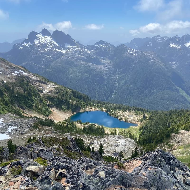

5040 Peak via Cobalt Lake Trail
Join us for a challenging alpine adventure to one of Vancouver Island's most spectacular mountain viewpoints!
This 8.4 km out-and-back packs a serious punch, climbing nearly 1,000 meters through rugged terrain on the way to stunning alpine scenery.
The trail is relentlessly steep, with plenty of exposed roots, rocky sections, and a few spots where you'll need to use your hands to navigate the terrain.
Our first reward will be beautiful Cobalt Lake, a crystal-clear alpine lake that makes for a perfect rest stop.
The Alpine Club of Canada cabin near the lake also adds a unique touch to this backcountry destination.
For those making the push to the summit, the payoff is incredible. Expect breathtaking 360-degree views of Vancouver Island's mountain ranges, Triple Peak, Barkley Sound's Broken Group Islands, and even the distant Coastal Mountains on the mainland.
We'll take plenty of time at the top to enjoy the views, refuel, and snap some photos before beginning our descent.
This is a physically demanding hike that requires good fitness and proper footwear.
While the distance is moderate, the steep terrain and elevation gain make this a challenging day on the trail.
IMPORTANT PARKING INFORMATION
1: Meet the group at the gravel pull-out right off Highway 4 (at the coordinates provided).
2: Turn onto the gravel road (Marion Main Line). Almost right away, you will drive over a big bridge crossing the Kennedy River. This means you are on the right track!
3: Keep driving up the wide gravel road. When the road splits into a "Y" shape, stay to the left.
4: The road will start getting very bumpy with big dips and rocks.
If your car is low to the ground (like a sedan), park on the side of the road here.
If your car is high off the ground (like a truck or SUV), keep going!
5: Keep driving until the road completely stops. You will see a big, open dirt circle where cars park, a wooden sign that says "5040," and a wooden bathroom. You made it!
Stats
• Length: 8.4 km out-and-back
• Elevation Gain: 924 m
• Route Type: Out and Back
• Difficulty: HARD
• Estimated Time: 5–7 hours
• Location: Strathcona Area
What to Bring
• Proper hiking boots with a strong grip
• 2–3L of water minimum
• Lunch + high-energy snacks
• Layers for changing weather
• Optional: swimsuit and towel
• Optional: hiking poles
• Good vibes & a smile ♥︎